The photos and commentary below originally appeared as a slide show, linked from my old blog on Digital Media Tree [post and comments] [slide show] [update]
The New Jersey wasteland in question is the acreage between Grand Avenue and Liberty State Park in Jersey City, an industrial zone that had gone to seed and would eventually become condos. In 2019, when I last visited the area, the park itself sported healthier-looking tree cover, while the canal basin appeared less ugly but still "transitional." The rickety footbridge across the canal inlet survived until Hurricane Sandy flooding destroyed it; a much sturdier metal bridge is there now. The city tore down the concrete plant and scrapyard buildings but a garbage barge or two still anchors nearby. They finished the road but it connects nothing to nowhere.
A surveyor told me that development of the area has stalled because of two factors: (i) it sits in the 100 year floodplain and no amount of legal redefinition/jerrymandering can change that and (ii) the end of the canal, near the bridge, has outlets for emergency sewage overflow. Meaning that when the system is strained they periodically discharge raw sewage into the canal.
So, here is my photo-essay from 2003, unaltered:
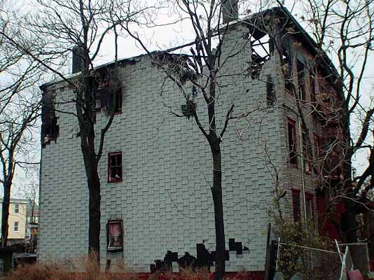
Our tour begins near the intersection of Grand St. and Jersey Ave. This decrepit structure sits across the avenue from a sleek new Medical Center currently under construction. Someone told me it was a crack den, but whatever--Little House on the Prairie it ain't. Like many dwellings in areas developers are keen to take over, this one recently had a "mysterious fire." I'm betting it won't last through 2003.
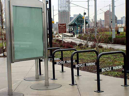
Just past the "crack house" is a stop for the newly constructed New Jersey Light Rail, which runs north-south from Hoboken to Bayonne. This is rose-tinted urban planning at its finest, completely out of step with the overall desolation of the area. Note the profusion of flyers in the kiosk and all the bikes in the bike racks.
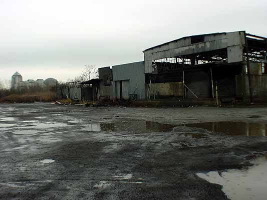
After the light rail stop, we walk past a (still active) concrete plant and a car-crushing facility. Now we're getting into the scary part. I call this the "recycling depot" but I really don't know what it is. It looks abandoned and is missing a good deal of the roof, but trucks still go in and out of the gates. Once I saw some cute girls in bikini bottoms and leather jackets doing a fashion shoot here, posing behind a chain link fence. I guess the art director thought the place looked punk. Oh, yeah, in the background is the Liberty Science Center, which has an IMAX theatre.
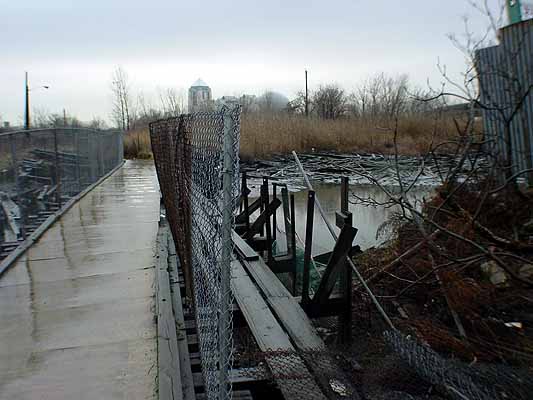
This, for me, is the high point of the tour--walking across the foetid Morris Canal on a rickety footbridge! The canal isn't really a canal anymore, just an inlet with decaying docks and a year-round ripe sewer smell. In the summer you have to walk really fast across this bridge before the mosquitoes completely drain you.
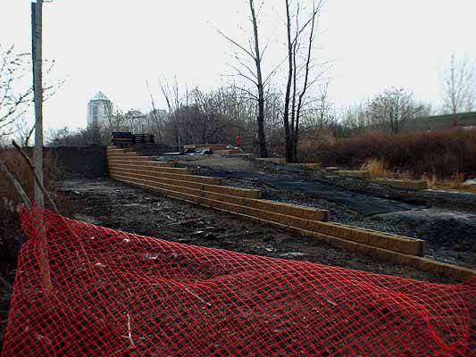
Between the footbridge and the entrance to Liberty State Park lay a neglected grassy area that was always a pleasure to walk through. Not anymore! The state has been busy the past few months paving over the whole strip and putting in a fairly useless looking cul-de-sac. What you see here is a wheelchair/bike ramp, under construction obviously, connecting the cul-de-sac and the footbridge. God only knows what new construction horrors await us. Seeing this last week actually gave me the impetus to do this tour, because I realized the little zone of rot I walk through is about to succumb to the attentions of the fixer-uppers. As much as I make fun of the decay in this area, I think its beautification will be worse. My solution would be: Just leave it alone, people! Let nature make it beautiful again, not you.
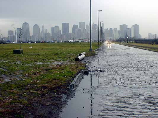
Skirting the cul-de-sac, we turn left and enter Liberty State Park, an enormous open expanse that's been under threat from developers since its inception. So far neighborhood activists have managed to halt plans for a golf course, a water park, and an amphitheatre on this property, which is reclaimed railroad and industrial land. That's the Manhattan skyline dead ahead, looking rather romantic in the rain. To the left is an approximately 10 acre grassy sward that was paved over and then unpaved after 9/11. Ostensibly the lot was for "emergency ferry parking" after Osama knocked out the PATH stop under the Trade Center, but--surprise--no traffic ever materialized. What seemed good for the country in that dire state of emergency was also good for the Tony Soprano Asphalt Company and its related entity, the Junior Soprano Asphalt Removal Company. Also note the spindly little trees added to the reseeded lawn.
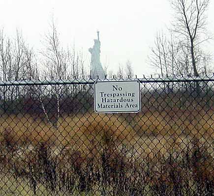
Strolling down the cobblestone street in the middle of nowhere, we see Lady Liberty off to the south (hence the name Liberty State Park). On the other side of the fence is marshland that's reportedly tainted with chromium from years when heavy industry dominated this area. Apparently there's an engineering plan on the boards to dredge and dig rivulets through the marsh and thereby restore it to an "authentic wetland." Christ, it just never stops.
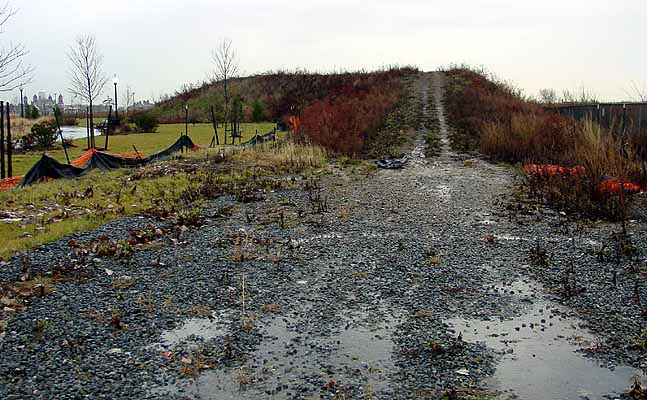
This is the mound of fill dirt left over from the paving/unpaving project, which I've been calling Mount Liberty. The state plopped this unseemly mass on top of the landscaped grass a year ago; about two thirds of it was used to cover the ex-parking lot and the rest just sits there, with no sign of imminent removal. Overgrown with weeds and still fringed with black plastic and orange security webbing, this hump is bigger than it looks in the photo; it's about twenty feet high, and when you climb on top of it you have a great view of New York Harbor. Maybe the state considers it an amenity now--or maybe they're just too broke to move it.
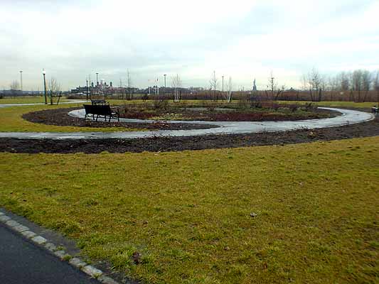
Did Robert Smithson submit early designs for the park? No, it's not the Spiral Land Jetty. It's one of the many landscaped areas with stunted trees, plants that never seem to grow in right, and unused park benches. Actually the park's biggest users were absent the day I took these pictures: the lazy good-for-nothing "golf course geese"--idiot progeny of government breeding programs to restore the formerly endangered Canada Goose--who pad about leaving their droppings everywhere.
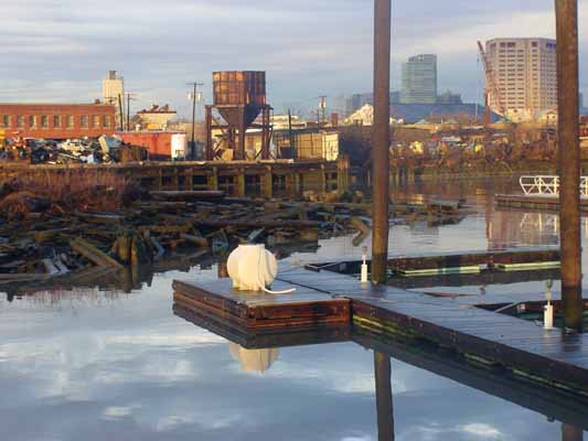
By now you're probably thinking, "God, this guy's a cynic. He just hates everything." So I'm going to end the tour with some photos I took after the rain ended, and the afternoon sun was peeking back out. Here's a view of the scrapyard from the park side of the inlet. The docks are part of the marina those developers managed to slip past...No, I'm going to end nicely. I think this is a lovely picture, and I doff my cap to the technicians at Sony whose digital camera made it possible.
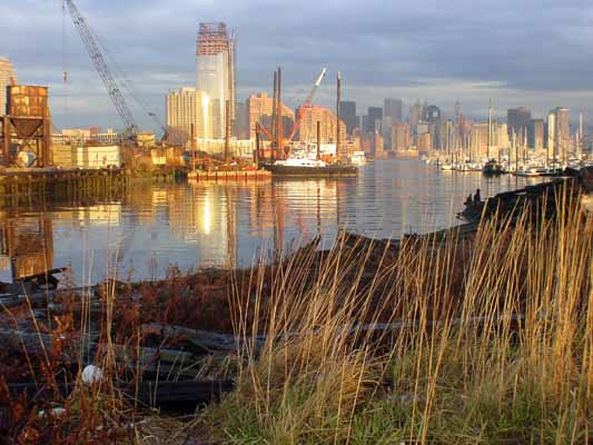
Another pretty picture: the Jersey City skyline, Manhattan skyline, and marina from the park, near the footbridge.
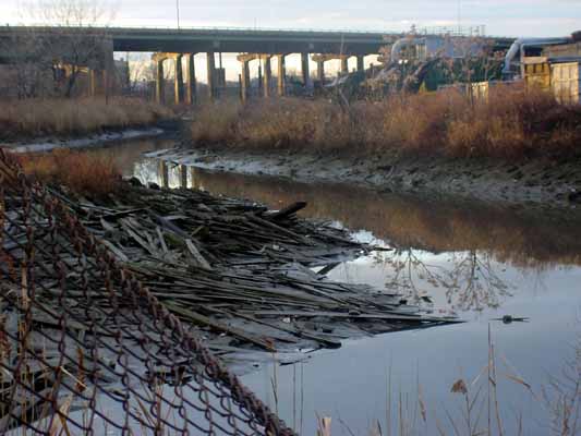
So we don't end on too sappy a note, here's the swampy side of the canal again, looking its toxic/fecal best, with rays of afternoon light hitting the Jersey Turnpike, off in the distance. Look now, and enjoy, because come the next economic upturn this will all spruced up and yuppified. Or maybe not.
Tom Moody, January 2, 2003